A Little Side Trip
We weren’t tired of Cape Town, quite the opposite. But, we had always wanted to see what’s known as the Garden Route. In 2016 we sailed the Garden Route but never had the chance to drive it. Here was a chance to see at least a part of it.

Starting off in Cape Town we drove directly to Knysna. Knysna is well known in the sailing community as it’s one of the very few places along the South African coast that offers excellent protection from the wildness of the southern coast. However, to get inside the heads at Knysna is a challenge. It’s not always possible to enter due to the breaking waves on the approach. Hence, sailing the coast in 2016 we stayed away but this time we visited on a beautiful day.
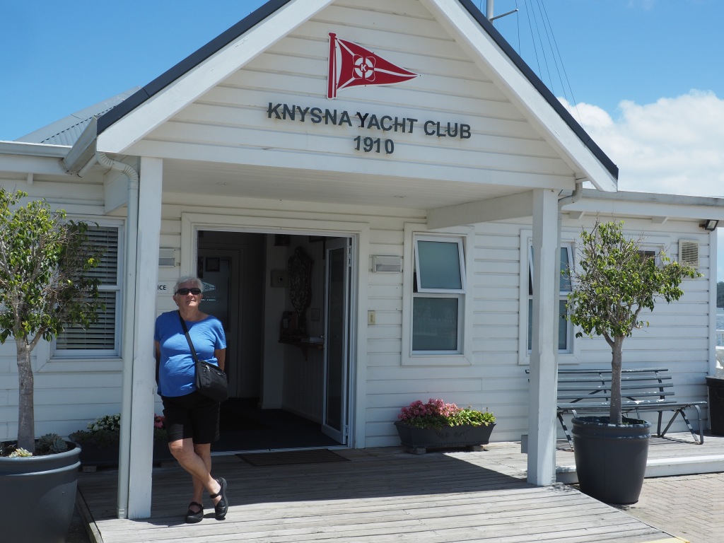


We stayed one night in Knysa making the rounds of pubs and bakeries. The best bakery in the whole of South Africa (that’s a big claim as there are many) is in Knysna – called Ile de Pain. An amazing place that truly makes excellent breads.


Unfortunately, we didn’t have a lot of time to spend here so the next day on to Plettenburg, which is situated close to Tsitsikamma National Park. The area is riddled with incredible hikes and beautiful beaches, of which we only managed to enjoy a few.

Regrettably, it’s a quick tturnaround for us and we head back to Cape Town with a one night stop in Agulhas, which is at the intersection of the Indian and Atlantic Ocean.

Then, it was back to Cape Town via the wine growing district of Stellenbosch. It was a lot of driving. The scenery, not only along the coastline, but through some of the most productive farming communities of the interior, is stunning with beautifully maintained small farming towns and as always good food to be had all along the route.


Wanderings
Cape Town is a great place to just wander. One’s safety antennae must be fully extended and put on high alert as there are times when one wanders “into the wrong side of town” without realizing it.
Our area of town is called the Gardens. Mostly a residential neighborhood with a number of streets populated by restaurants, bars, clubs and small shops of a great variety.

However, our wanderings take us far and wide, getting around on foot, by local buses, and occasionally by Uber and/or Bolt. Everyone has been incredibly helpful, providing lots of warnings about not engaging with people, staying safe, and directions to the best things to see.
Yes, there are definitely areas we don’t go to and times of the day/evening that keep us restricted to certain districts. We have never felt unsafe or threatened and mostly quite the reverse.


Then there are those things one comes across unexpectantly. And here, Connie is druelling over a used Land Cruser thinking of all the places she could explore in the southern and eastern parts of Africa. The Toyota Land Cruiser is what we used in Botswana and lived in for almost a month. A tank of a vehicle.

This past Sunday was really the first real summer day we’ve had in Cape Town – temperature of 27C, lovely wind blowing and we were ready for a day off. No exploring, no must do items. Just relaxing in the back patio of our rental suite.


Ode to the Optometrist
I had read about this old optometrist building in downtown Cape Town and decided to make an effort to see the storefront.

Downtown Cape Town is full of great examples of art deco architecture. Muller’s is one of the few remaining examples of street level art deco storefronts.
Entering into the building, the interior has been kept close to the original layout. It’s dark but priceless.

While marveling at the interior we happened to run into Mr. Muller who was just exiting the building when we entered. After a brief conversation, we were invited to view the museum on the third floor.
Rising to the third floor in an original cage elevator, we engaged in a lengthy conversation about sailboats and not the museum!


A lovely exchange was had learning about the Muller family history and the business, and then we were off to lunch.
The Flower Market
On Adderley Street, there’s a great Flower Market. It’s not huge, but it’s colorful and has a great selection of protea.


Shaking Out the Sand
Okay, we are sweeping out the sand from our ears, sweeping the elephant dung out of the tire treads and putting on a fresh set of clothes and throwing out the old!

We’re down at the ocean and approaching Cape Town. The tablecloth is on the mountain overlooking the city, the sharks are circling in the water, and we’re ready for a little of the uban life.
We are familiar with Cape Town having lived here on and off over a year in and around 2016. However, back then all we could think of was how to prepare SV Sage for the next part of her voyage across the Southern Atlantic ocean and north to the Caribbean.
We spent most of our time searching out boat parts, fixing engines, sewing tarps, building dodgers, painting the hull, and a variety of other boat projects. We never really got a chance to be a tourist, so now we have a chance to snoop around the nooks and crannies of Cape Town. And what wonderful places to discover.
We did, though, return to one spot not so much in Cape Town itself but out in wine country. Jordans, no relation to the Canadian wine maker, is out near Stellenbosch and has a lovely setting with an exquisite restaurant.
Since it was the last day in South Africa for Dave and Lesley we made a day of heading out to the vineyards and having lunch at Jordans – a 3 course meal (which we certainly didn’t have camping in Botswana) followed by a cheese plate featuring some excellent South African cheeses and a plate of delicacies provided by Jordans after dessert!


I have to say that was a good start to our stay in Cape Town. If I could only repeat that a few more times I may never leave.


Kruger Park
We were here in 2016 and expectantly not much has changed. Still a wild and open area made for wildlife and not humans.
Ah, but wait. There seems to be a lot of people in the park. Park rules mandate that you cannot exit you car other than in the camp areas, and these areas are teeming with visitors.
Our camp for 4 days was Satara, which in a north-south line is about halfway between the northern Pafuir gate and the southern Malelane Gate. The park is narrow and long and borders to the east with Mozambique. The length of the park is 528km so it can take days to cover the park since the maximum driving speed is 50kph.
The other camps where accomodation is available include Shingwedzi, Mopani, Letabe, Olifants, Skukuza, Hamilton’s and Berg-en-Dal Rest Camps.
We each had a rondavaal which were self-contained and had an external kitchen.


Finally, 4 days in which we didn’t have to pack up the tent in order to head out and go animal hunting.
To go out looking we would pile into the truck at 0600hrs and spend a few hours driving around to see what we could find. Then return to camp, have breakfast and repeat at around 1600hrs.
We didn’t manage to see all the animals we were looking for but a good portion of them. The previous posting had a few of the animals we were able to photograph, but I will leave you with the last photo I took as we exited Kruger Park on our way to Johannesburg.

The Natural World
I guess one of the main reasons we came to this part of the world was to see the different components of the natural world.
Here is a small sample of the world we have seen and photographed.


Back to South Africa
Okay, time is running out. We have to make a run for it and get to Kruger Park before they give up our reservation. It’s way more officious than travelling through Botswana but we’re hoping for cooler weather as the afternoon temperatures of low 40s is starting to wear us down.
It’s 2 days to travel south from Chobe to the Botswana/South Africa border. Great road, not much traffic and fewer animals (cows and donkeys) on the sides of the road. But then we spent 2 days driving to the border through a landscape of dried thorn bush (acacia), sand, and the alongside occassional fields with a crop or crops that we can’t identify.

First overnight stop was Francistown. A slightly rough but quiet campground behind some confrencing facilities. Hot showers with pounding water pressure washes away the salts and dust of the day and we’re ready for dinner around the brai.
Next day the dreaded border – this time it’s closed. System failure. Trucks are lined up for miles and everyone is irritable and anxious. We want to get through and on to our campground, which isn’t too far away, but for a while, unobtainable.

Finally, after only a short while, all that despair was for nothing, and systems are up and working. Traffic moves and cars go to the head of the line – yahoo. We’ve re-entered South Africa, and our old visas are working but not our SIM cards that we had bought and used in South Africa. I should say mine didn’t work, but Connie’s did – aargh.
Another night at Moriti on the banks of the Limpopo River. Sounds exotic, but it’s so hot and still that it doesn’t cool down until about 2300hrs. I had lit the brai to cook some chicken, which made it feel even warmer as the smoke swirled around the campsite and didn’t clear off immediately.
Up early and on to Hoedspruit, our last stop before 4 days in Kruger and a chance to provision. A prosperous town due to the large number of private game reserves that dot the landscape around Kruger National Park. It kind of feels like driving through The Hunger Games, but instead of people caught in the game, it’s exotic animals!
Onward to our new 4-day home – Satara Lodge, an hours drive from Kruger’s eastern entrance Orpen Gate. Unload the truck from 3 weeks of camping, finally open our suitcases and see what clean clothes we can revive and shake out the kilos of dust from inside the truck.
One of the Greats
What am I talking about?

Kasane – Dave and Lesley have retired to the Chobe Safari Lodge while we get to stay in the lodge’s campsite. An advanatage of being at the campground lodge and having Dave and Lesley stay there is that we get to take advantage of a few of their local tours. One of them is a drive to Victoria Falls.
Victoria Falls is one of the 3 great waterfalls of the world. There is, of course Niagara Falls and then there is Iguazu Falls. Each one has a record; Niagara Falls has the greatest volume of water, Iguazu has the widest falls, and Victoria has the highest.
Although 3 countries border on the falls (Botswana, Zambia and Zimbabwe), one is best to see the falls from the Zimbabwe side. We chose to visit using the tour from the Chobe Safari Lodge which took us first to the border with Zimbabwe where all the formalities of crossing the border had to happen including a per person charge of 900pula – approx Cdn $100. That’s for a one day visa and no longer, so don’t get left behind somewhere on the day tour.


The falls are about a one and half hour drive from Kasane and the van took us to the National Park where they left us for about 5 hours. That’s more than enough time to walk through the park and along the falls.
By 1500hrs we are all lagging and looking forward to the bus arriving back in the parking lot at Victoria Falls. We clamber in and repeat the process; an hours drive to the border, 30 minutes to clear customs and immigration and then another 30 minutes to drive back to Chobe Safari Loddge to collapse into a comforatable sofa and enjoy a gin and tonic on the banks of the Chobe River – this is decadent but then we have to go back to the campground while Dave and Lesley continue to lounge in splendour.
Just to make sure there is a clear separation between the campers and the lodge-sitters, there is a sign on the path back from the main lodge to the campground – see photo below

Not only crocodiles wander the riverbanks but hippos can be heard belching and croaking away demanding their space. Thank god there’s an electric fence between our campsite and the Chobe River!

Water, Water, Water But None to be Found
9 days crossing the most parched territory. No rain has fallen for 8 months in this region. Rivers that normally flow from season to season have not seen water since 2018.
Where are we? Even for me that’s a difficult question. I am usually really good at having a mental bird’s eye view of where I am and where I’m going. However, this region baffles me.

This is a smaller scale map giving a better idea of where we are in relation to Zimbabwe to the east, Namibia to the north and west and South Africa to the south.

The area we have been travelling to is the repository of all the water flowing in from the Angolan hills. The water flows south along the Angolan/Botswana border, finally disappearing somewhere between the Chobi River and the Kalahari desert in Botswana’s southwest region.
The landscape has been sparse, and at the end of the winter season, there are few trees with any greenery. The rainy season has started, and we are plagued by threatening black skies in the late afternoon with viscious looking lightening and thunder. But rain? Non-existent or none….a few drops hit the top of the tent and disappear or evaporate before they hit the ground.
What little water has fallen has produced amazing results. Sitting in a campground for 3 days in Chobi National Park we noticed green shoots growing at the rate of about 12mm/day. Trees are starting to sprout leaves and some water holes are getting replenished.
Some areas do experience a deluge for a short period. This presents obstacles for those of us driving through these areas. We have driven nothing but sand roads for 9 days. They are challenging, but I will give full marks to the Toyota Land Cruiser – an amazing vehicle with hi/low 4 wheel drive and a differential that gives the ability to lock all wheels together to drive through deep mud. Tires must be deflated from 3kpa to 1.6kpa for the deep sand. We haven’t got stuck yet and hope never to meet mud that bogs us down to a stop and leaves us as bait for lions!
Here are a few pictures from the last 9 days.


